|
<<Back |
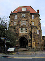
Hadrian's
Wall Path, England
Sept
24 - Oct 2, 2009 |
|
|
|
|
"That's it!", exclaimed D
with an old travel magazine open on his lap.
"What's it?", inquired J without even looking up from
her laptop. "I know what I want to do for my 40th
birthday", D replied. "That's great dear", said J
with her usual dismissive eye roll. "We're going to
walk across England", said D, "Coast to coast".
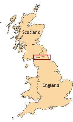
It was to be our first true
peregrination – an 84 mile trek along the ancient frontier
between England and Scotland. We had been researching
possibilities for years, and the combination of history,
scenery, and beer on the Hadrian’s Wall Path met most
of our criteria for a worthy vacation. Our trip got
off to a celebratory start as our flight included a
90 minute layover in Dublin on the 250th anniversary
of Arthur’s Day when the Guinness brewery was founded.
We dutifully toasted the occasion with a couple of freshly
pulled pints at 4:30 am. Our plan was to land in Edinburgh
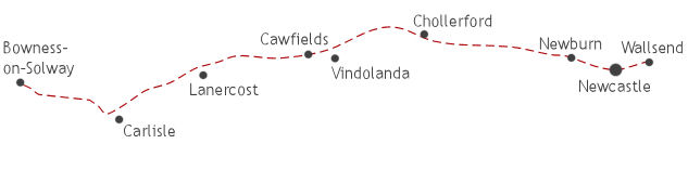
and then travel by train to Newcastle from where we
would begin our westwardly walk to Bowness-on-Solway.
We felt comfortable that we could complete the journey
in eight days which would leave us time to see some
of Edinburgh before returning home.
When Hadrian succeeded his adoptive father Trajan
as emperor of Rome in 117 AD, he inherited an empire at its
greatest extent, reaching from Mesopotamia to North
Africa to Britannia. Consequently, a vast military was
required to
maintain the borders, and these soldiers needed to be
fed, paid, and kept occupied to remain loyal to the
republic. In the forty some years that Romans occupied
the British Isles, they were unable to conquer Scotland,
as the Pict tribes in the north proved to be
a formidable opposition. It is believed that Hadrian made the decision to
build a stone wall from the mouth of the Tyne River to Solway Firth as much to protect Roman Britain from the
Picts as to keep his troops from the temptations that
accompany idleness.
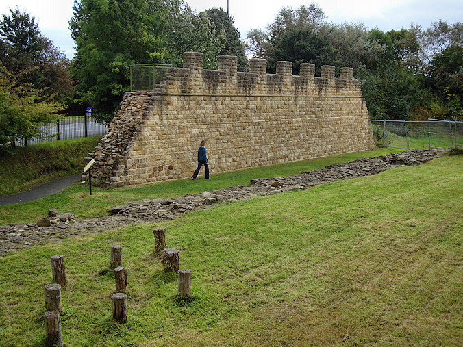
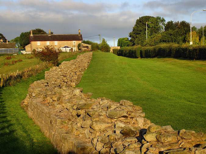
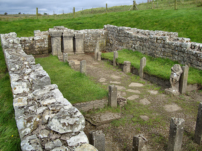
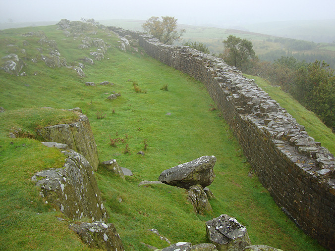
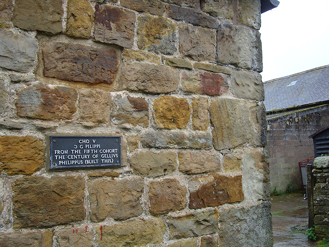
The 10 year endeavor to build a wall across England
began with a 10 foot wide stone base known as the Broad
Wall, but after a period of time the wall base was reduced to
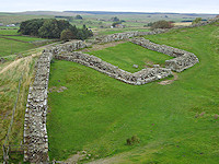
8 feet perhaps in an effort to speed construction. Situated every Roman mile along the length of the
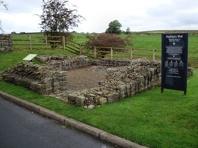
wall are small fort-like structures called milecastles
which were used to house troops and often to
control traffic through a nearby gate. A Roman mile was about 5,000 ft and equated to
the distance a legion travelled in 1,000 paces (mile =
mille), so there are 80 or so milecastles along
the length of the wall. In addition, there
were also believed to be 17 forts which could hold another 1,000 soldiers each and were vital to providing
security and storing supplies. Local Britons often provided goods to the fort,
and in some cases small civilian settlements began to
form on their periphery which were precursors to some of the towns
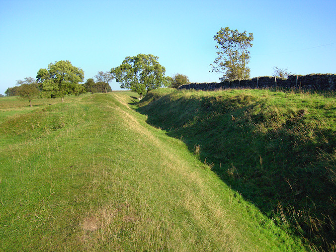
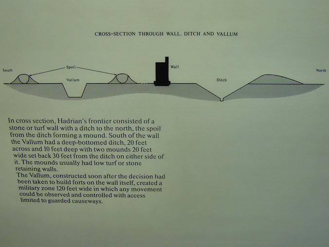
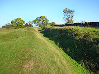
in the region today. While the wall was estimated to be between 12 and
15 feet high in places, the height was bolstered by a 6
foot ditch dug at the base of the northern side of the
wall. To the south of the wall, another broader ditch called the
vallum was created to perhaps designate the beginning of the
military zone and serve as a barrier to the civilian
population.
Between the vallum
and the wall ran a military road used to move supplies
and troops between milecastles and forts.
When Hadrian died in 138 AD, his own adopted son Antoninus Pius became emperor and abandoned the wall in
favor of a new shorter wall 100 miles to the north
between the firths of Forth and Clyde. Consequently,
Hadrian's Wall began to deteriorate from
neglect, and locals used it as a quarry to provide stone
for new buildings. A considerable portion of the wall
was destroyed by General George Wade who built a military road as a
means to easily transport troops along the frontier with
Scotland to quell the Jacobite uprising led by Bonnie
Prince Charlie. Much of the credit to the wall's survival is attributed
to John Clayton, a Newcastle lawyer, who began buying up
farms containing remnants of the wall and investing the
profits into its reconstruction. Just about all of the wall standing today has
been partially reconstructed by either Clayton or the
National Trust. |
|
|
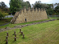
Restored section of wall
|
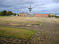
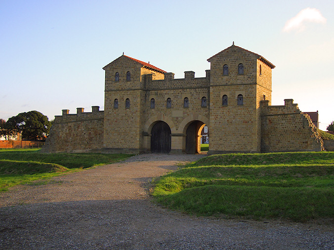
Roman ruins of Segedunum
|

Arbeia
|
|

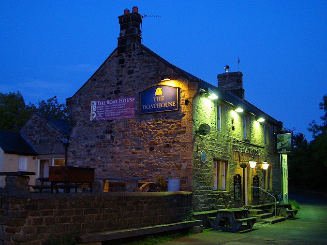
The Boathouse Pub
|
Segedunum
|
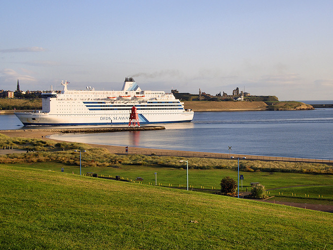
Mouth of the Tyne from South
Shields
|
|
|
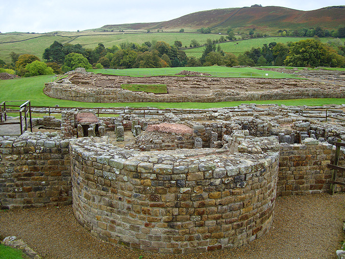
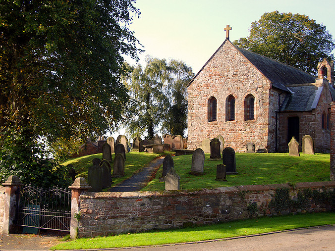
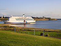
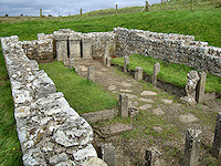
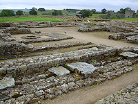
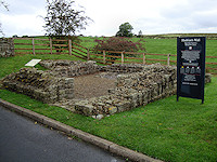
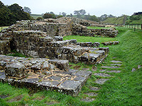
Newcastle itself is located a few miles inland from where
the Tyne River meets the North Sea. The Romans actually
built fortifications overlooking the mouth of the Tyne at a
location known today as South Shields. The fort was known as
Arbeia and was used to protect the Tyne as well as provide
supplies to the legions guarding the frontier. Some of the
site has been reconstructed but the fort remains an active
archeological site.
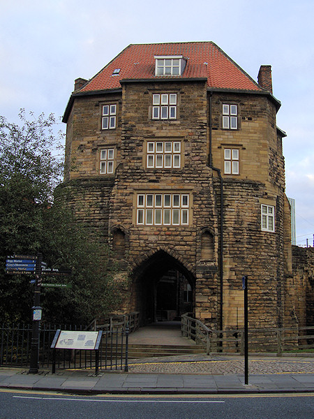
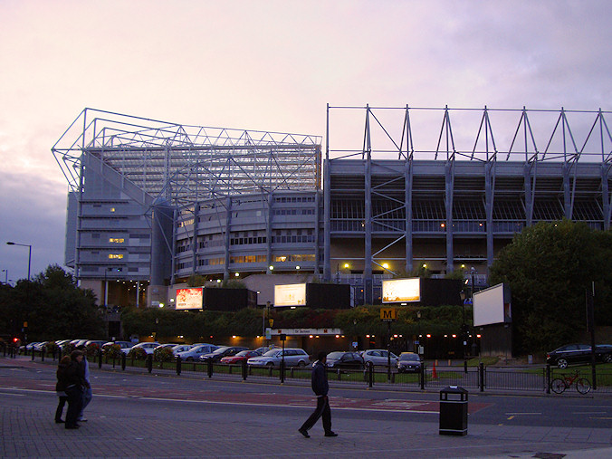
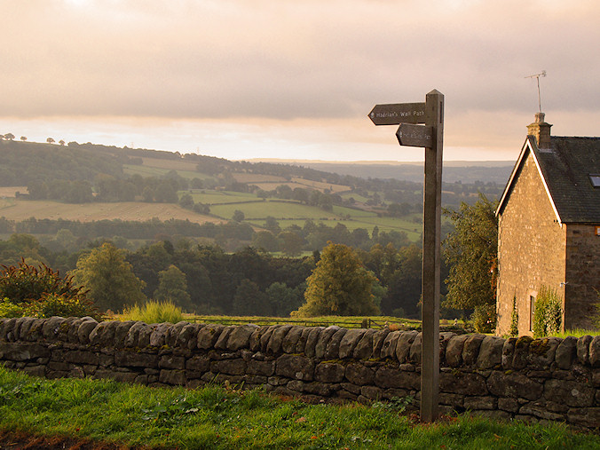
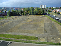
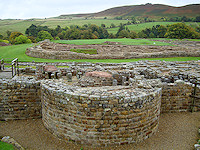
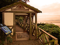
The official National Trail actually begins not surprisingly
at Wallsend on the outskirts of Newcastle. From South
Shields, we crossed the Tyne by ferry and then the Metro to
the starting point of our trek. Segedunum, a massive Roman
fort marking the beginning of Hadrian’s Wall and the walking
path itself. The glass observation tower offers a panoramic
view of the excavations, but perhaps the most interesting
feature is a reconstructed segment of the wall giving one a
glimpse of the imposing 15 ft high barrier that the
tribes to the north had to face.
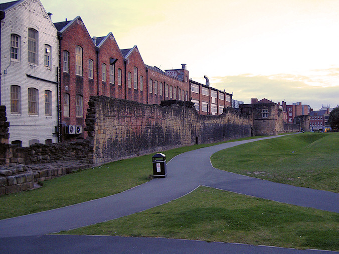
The course of the original wall runs through downtown
Newcastle and essentially none of it remains today.
Therfore, the path winds along the banks of the Tyne
past clusters of condominiums. Newcastle, too often thought
of as a center of coal and industry, has more recently
become known for its youthful population and vibrant
nightlife. In fact, the central location of our hotel made
it a popular accommodation for members of hen or stag
parties carousing to the wee hours of the morning.
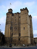
Newcastle-upon-Tyne, as it is officially known, had its own
origins as a Roman fort called Pons Aelius, alluding to a
bridge that one crossed the Tyne at that point. This was the
original endpoint of the wall, but it soon became evident that
the natives to the north could cross further downstream so
the wall was extended to Segedunum. The Pons Aelius site has
always had strategic importance and has been continuously
fortified even after Roman rule came to an end when the town
became known as Monkchester. It wasn’t until the Norman
Conquest that the elder son of William the Conqueror chose
this site to build a new castle in 1080, giving the city its
present name.
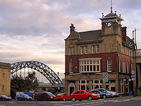
As we made our way past the various bridges spanning the
Tyne, we began to feel the effects of the long flight and
the time change. There was still some daylight left so we
traversed Newcastle’s old town to see remnants of the
city walls before settling down for a pint of Newcastle
Brown at the spectacularly situated Bridge Hotel. We had
comfortably walked about 4 miles on pavement and felt pretty
good despite having arrived by plane that morning.
We got a late start the next morning to shake off the jet
lag but knew we didn’t have too long to go for the day. Once
we figured how to get back on the route from our hotel, the
walk was quite pleasant as it followed the course of the
Tyne through the Newcastle suburbs. This was our first
segment wearing our backpacks, and it took some time to get
used to them. Many people who hike the entire trail have
their belongings driven to their next destination, but this
felt like cheating to us somehow, so we decided to hike with
packs, hoping that we wouldn’t regret it. Our main concern at
the moment was where we would stop for a pint and a pee.
Surprisingly, the sun beat down on us for most of the way
and much of the walk was on pavement, but we soon settled
into the Boathouse for a refreshing Boddingtons knowing that
our ultimate destination for the evening was only a few
yards down the road at the Big Lamp Brewery and Inn. We
spent the rest of the evening securing provisions for the
next segment of the journey, confident that we could handle
the rest of the walk if we got an early start each morning.
|
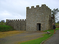
Newcastle Keep
Bridge Hotel
Black Gate

City walls
Travelers' respite
|
|
The path forward
|
Newcastle bridges
|
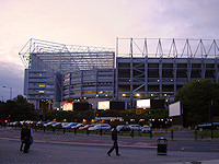
St. James Park
|
|
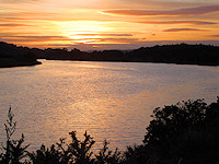
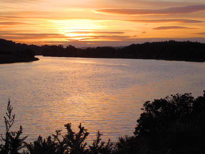
Tyne sunset
|
Wallsend
|
The Keelman
|
|
|
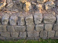
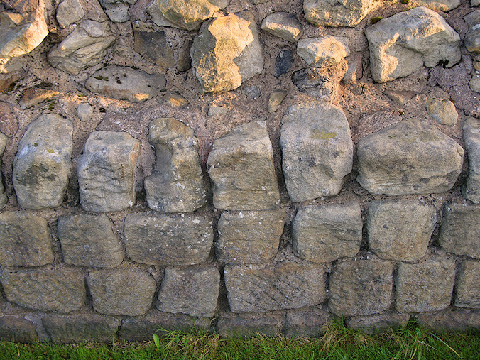
Stones with tooling marks
|
Heddon-on-the-Wall
|
J navigates the minefield
|
|
|
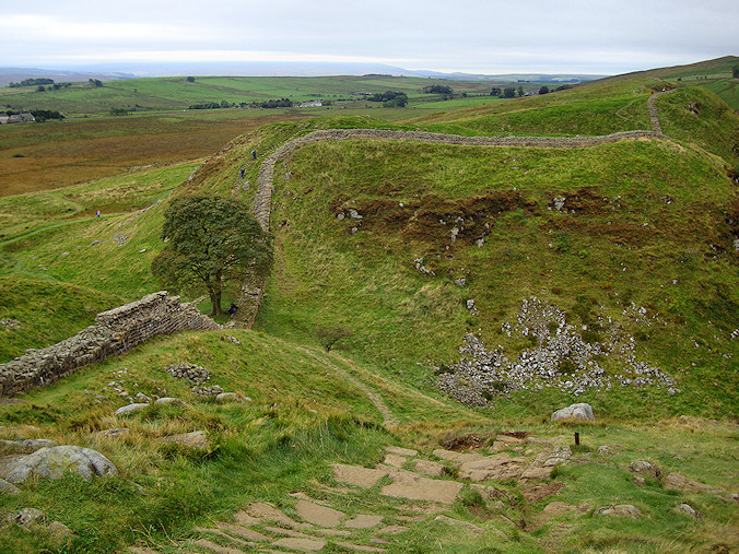
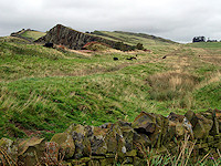
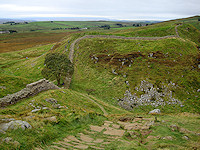
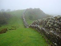
The stretch of trail ahead was expected to be long – the
longest of the entire journey. We started out before sunrise
hoping to make it to Chollerford before dark. Heddon-on-the-Wall
gave us our first genuine glimpse of what was to come. Just
off the trail was a 150 yard section of the Broad Wall which
somehow escaped General Wade. We took some extra time
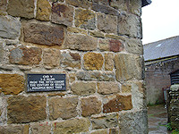
examining both sides of the wall noting the tool marks still
visible on many of the stones. It was early on a Saturday
morning, and not much was open in Heddon save for a gas
station. We loaded up on cold meat pies for the march ahead
unsure if we would find anything else before lunchtime. The
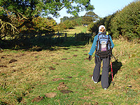
terrain was mostly asphalt until we hit the farmland which
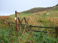
required passing through gate after gate after gate - loads
of gates that the guide books failed to mention. While most
were contained swing gates that offered only enough room for
a walker to squeeze through, there were also the more
cumbersome ladder stiles which requires one to climb steps,
carefully straddle the wall or fence, and then descend the
other side. Not as easy as it sounds with a full pack on
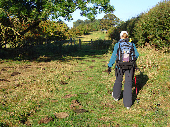
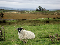
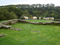
your back. We trod on through a number of fields taking care
to give wide berths to the cows and especially their calves.
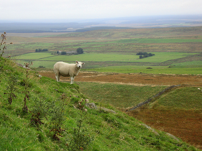
Just before we left the US, we came across a news item in
which a third hiker of the year had been trampled by a cow
in the UK. There was even a hotline to call if you were
attacked or chased by a cow. What began as concern quickly
turned into alarm when we began to see how many cows we
would ultimately encounter on this trek. We followed a few
basic steps to ensure our safety – approach the cows slowly,
talk to them so that they know you are there, avoid the
calves at all costs, and be prepared to run like hell just
in case.
We took refuge at the Robin Hood Inn for a hot lunch and a
cool pint of ale. We were both feeling the pain as blisters
started to form and joints began to ache from the constant
pounding of our packs. It took all our energy to leave the
comfort of the inn and get back on the trail. Chollerford
could not come soon enough, and when it did, we had put in
18 miles for the day. Unfortunately, we still had one more
to go to reach our accommodations in the neighboring town of
Humshaugh. Due to a kitchen problem, the innkeeper could not
provide us with any food, so we ate what remained of our road
snacks, showered, and fell into bed thoroughly exhausted. We
stared at the ceiling, unable to move, and had an earnest
discussion about giving up the absurd idea of walking the
next segment settling instead for taking the bus. We decided
to sleep on it.
|
|
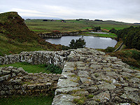
Chollerford Bridge
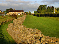
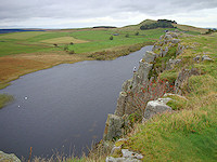
|
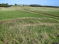
Traces of the Vallum
|
The North ditch
|
|
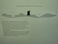
Profile of wall system
|

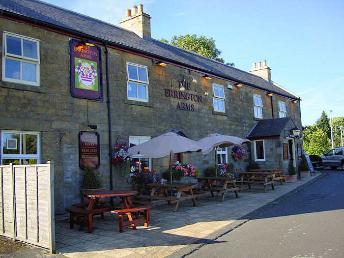
The Errington Arms
|
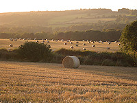
Early morning hay bales
|
|
|
Arched entry
|
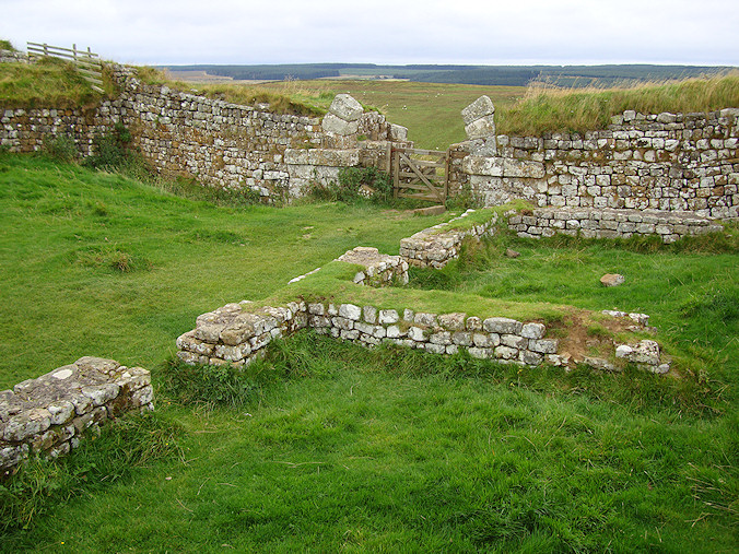
Burnhead
|
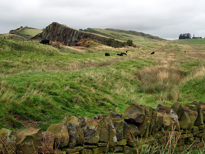
The Vallum at Cawfields
|
|
|
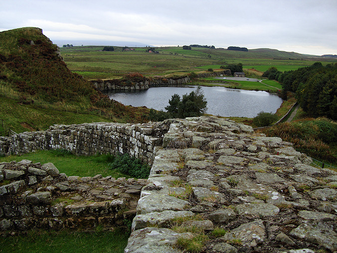
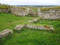
Mithras temple
Showing us the way
Crag Lough
Eeeeeeasy, Big Fella
The fort at Housesteads
|
A good night sleep did wonders for our physical and
psychological wounds, and we were back on the trail again at
7 am the next morning brimming with confidence. The
innkeeper scrounged up some containers of
yogurt and a couple of bananas to take with us on the
upcoming stretch. We were in to the most scenic yet
demanding part of the hike. The sharply angled crags formed
by glacial erosion provided spectacular views of the border
country to the north. The early morning sunshine quickly
turned to overcast skies, and the westerly wind began to
pick up. Although most (if not all) of the guidebooks lay
out the segments of the walk from east to west, it seemed
that most of the hikers we met were working their way to
Newcastle. We were about to learn the hard way that walking
eastward is the more traditional direction as it keeps the
wind to your back.
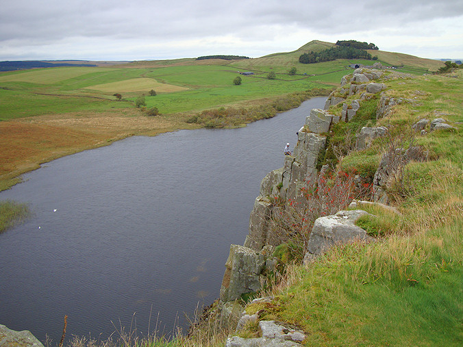
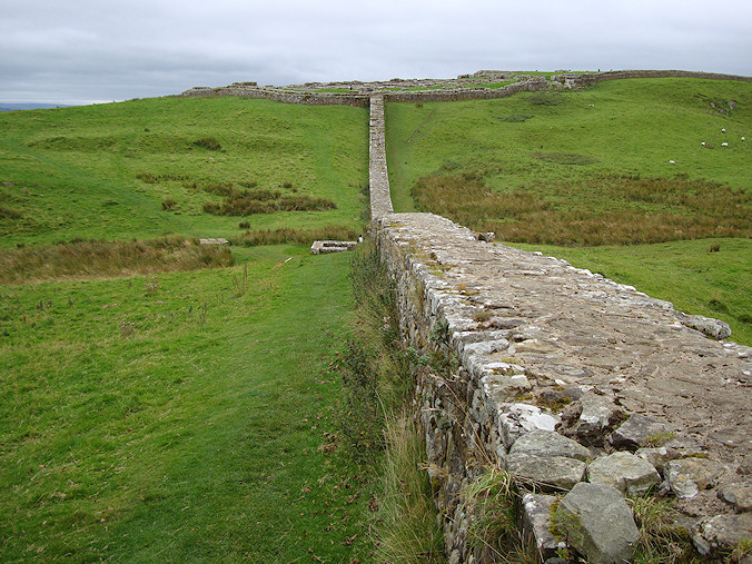
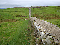
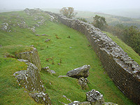
As we pushed on, it became evident that this section of the
journey was as advertised, and the views of the serpentine
wall disappearing over the crags were worth the effort it
took to get there. The climb down the crags seemed much more
demanding than the march up, and we soon began to feel the
pounding on our knees. As this part of the trail entered the
Northumberland National Park, there were no towns at which
we could stop to rest and replenish ourselves. Our morning
rations were long gone, and we began to get concerned as it
was a Sunday which meant there was no guarantee that
anything would be open. Discounting our meager breakfast
rations, we had not had a proper meal since the day before,
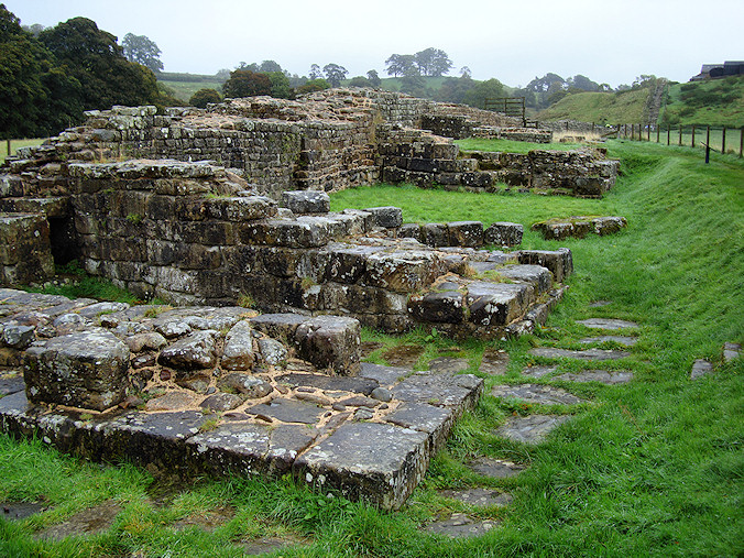
and we had completely run out of water. We had trod up
another hill along the length of the ruined Roman fort at
Housesteads when our salvation appeared before us like a
vision – the fort’s gift shop. In true barbarian spirit, we
raided it. We relieved them of all their bottled water and
bought a tower of exquisite chocolate-covered shortbread. To
the dismay of the other visitors, we sprawled out on the
lawn outside the shop to air out our socks and tear into our
plunder.
After a bathroom break and a sock change, we pressed on past
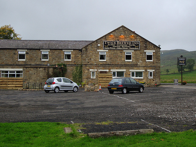
scenic Crag Lough and the famous Sycamore Gap. As we reached
Twice Brewed, we were already spent. Our feet and knees
ached from the nonstop ascent and descent over the crags,
but we knew that our B&B was still some 3 more miles ahead
of us. We paused for awhile looking at the inn about a half
mile downhill off of the trail. We could almost smell the
food and hear the clanging of pint glasses. How far was it
really? How many steps would that be? Did we have the energy
to make it back up the hill? Maybe we could stash our packs
somewhere and walk there. Would we have enough time before
it got dark? We sat and debated for awhile, running over the
calculations. Reluctantly, we decided to plod on hoping to
reach our final destination before nightfall.
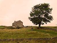
After another half hour, we could see the farmhouse that was
to be our B&B for the night materialize in the distance. It took us
another hour to actually reach it. The final few hundred
feet of the walk was surreal. As we rounded the quarry at Cawfields
which had provided stone for the wall, we heard the
sound of bagpipes. A solitary piper stood by the water
practicing his craft and supplying us with a soundtrack to
finish the day’s 15 mile effort. We staggered up the
driveway and were met by our hosts. After a shower and a
change of clothes, we hobbled down the road to the Milecastle Inn where we dived into wild boar and duck meat
pies, sticky toffee pudding, and copious amounts of local
ale. In the meantime, our gracious hosts at the Burnhead B&B
were kind enough to do a load of our laundry to give us
enough clean socks to make it to the end.
|
|
Sycamore Gap
|
Cawfields Quarry
|
Milecastle #42
|
|
|
A turret at Vindolanda
|
Vindolanda
|
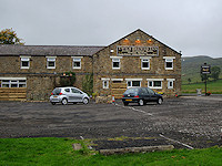
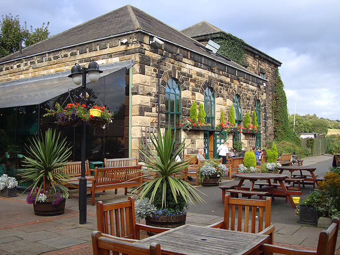
Twice Brewed Inn
|
|
|
Thankfully¸ we planned a day of rest with which we could
ride the Hadrian’s Wall Country bus to see a few of the
forts and museums that had eluded us thus far. Our main
objectives were to separate ourselves from our backpacks for
a day and spend as little time on our feet as possible. We
toured the Roman Army Museum to study some of the artifacts
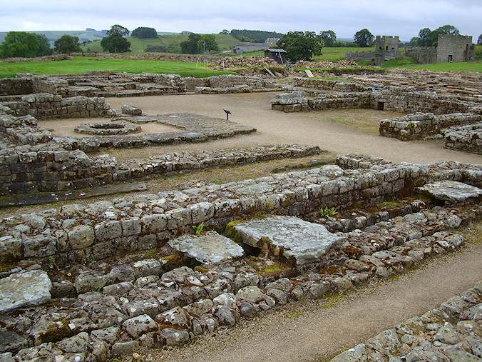
from years of excavations in the area. We also visited the
great fort at Vindolanda which pre-dated Hadrian’s Wall by
40 years and was one of the key border fortifications since
the beginning of Roman rule in Britain. Despite our desire
to see more, we knew it was in our best interest to rest,
which we did at a corner table in the Twice Brewed Inn.
|
|
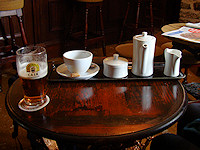
Tea time
|
Roman milestone
|
Vindolanda ruins
|
|
|
Early morning mist
|
Misty wall
|
Curious local
|
|
|
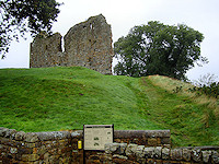
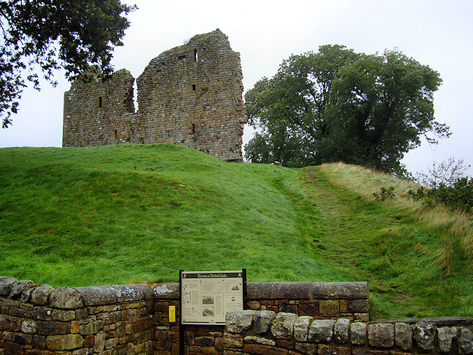
Thirlwall Castle
Intersecting the Pennine Way
Wall stones in local farmhouse
Turret ruins
|
While the one-day respite permitted us to rest our weary
feet and joints, it also allowed the rain clouds to move in.
For the first time, we had to break out our wet weather
gear. Before embarking on this adventure, we spent a lot of
time planning on what we should take along. Knowing that we
would have to sling our packs all day long, we needed to
pack carefully. We tried to stay optimistic about the
weather, but we knew that the odds of avoiding rain for
seven days running in the north of England were not good. It
was clear we needed some protective rain wear. So we each
bought a lightweight jacket and pants on the day before we
left which proved to be a wise precaution.
It was only a drizzle, but it was enough to soak our clothes
over the 15 or so hours we had to walk that day. The trail
also began to muddy, and the steppingstones used to descend
the steep crags became treacherously slick. All of this ate
into our pace, and we began to lose significant time. Our
plan was to make Gilsland for lunch. The terrain soon
flattened out and we were once again cutting through farms
which helped us get back on track. We made Gilsland just
after noon only to find all three pubs in town closed during
lunchtime for reasons we still can’t understand. We ended up
drying out in a tea room while
noshing on paninis and chatting with some fellow walkers.
The rain began to let up, and we ventured out again crossing
farms and back country roads that led out onto a plateau. We
had a magnificent view of the River Irthing and the valley
through which it ran. We soon came to an interesting site
where the wall crossed the river. Here the wall was
transformed into an arched bridge wide enough to drive a
chariot over it. Remnants of the abutments can still be
seen, and experts speculate that towers stood on both banks
from which Roman soldiers could patrol this potential breach
in the wall. These soldiers were most likely housed at the
nearby Birdoswald fort only a few hundred feet further up
the path. We stopped at the fort for a nature break and to
have a bite to eat. It was also one of the designated
stamping stations. When we began the walk at Segedunum, we
each picked up a Hadrian’s Wall Passport to be stamped at
certain points along the way. If all six stamps were
collected, we could exchange the passport for a certificate
commemorating our successful completion of the walk.
We kept moving as the afternoon wore on making frequent sock
changes on account of the rain. Just before turning off to
Lanercost, we happened upon a workshop where a man and his
son were printing up t-shirts. We investigated further to
find that they sold these Hadrian’s Wall souvenirs to
walkers. D appropriately bought a shirt stenciled with a map of the trail
and the words "I came, I saw, I blistered" across the chest.
We were reluctant to add any additional weight to our packs,
so we paid the extra few pounds to have it sent directly to
the US. That evening, we dined with our B&B hosts who were
also kind enough to do some laundry for us. We dried out our
belongings and enjoyed perhaps the best hot shower in all of
England.
|
|
Bridge abutment
|

Birdoswald Fort
|
Milecastle #49
|
|
|

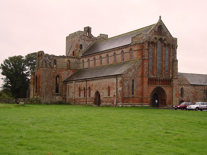
Lanercost Priory
|
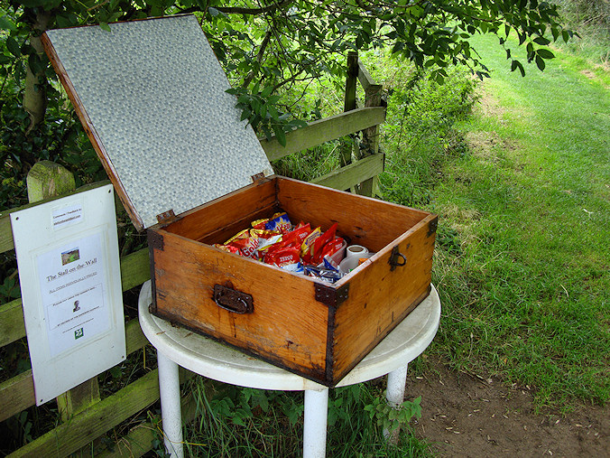
Honesty box
|
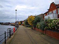
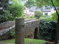
Rickerby Park
|
|
|
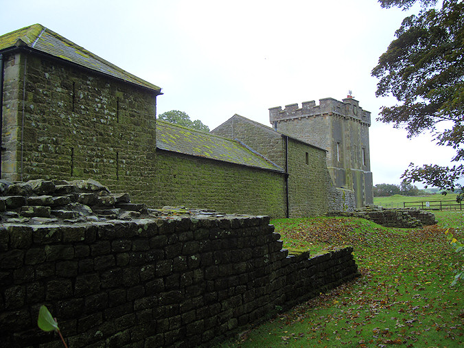
We were on the road again early the next morning;
however, we couldn’t leave Lanercost without paying a visit
to its top attraction. The Lanercost Priory is notable in
that it hosted King Edward I and his royal court while his
majesty recovered from dysentery for 6 months in 1306. The
priory itself dates back to the 12th century and was
constructed using some of the stones from Hadrian’s Wall. We
spent a few minutes roaming the grounds, but were eager to
get on our way to Carlisle.
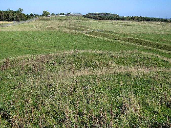
Most of the impressive sections of
wall were behind us. Near Dovecote Bridge, we came upon a
mound of turf which was part of the original wall uncovered
some years ago. After just a
short period of time, the sandstone began to show signs of erosion,
and the section was again covered up to preserve it. A
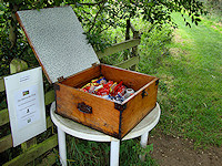
little further on, we found an honesty box filled with
chocolaty goodness. The concept involves selecting what you
want, be it candy, chips, or a drink, and putting money in
the box for what you have taken. As Americans, we were a
little surprised that the money hadn’t been stolen, or the
candy, or even the box for that matter. It was nice to see
that the honor system was alive and well.
We passed on the honesty box in
favor of something warm to eat for lunch at the Centurion
Inn, one of the most well-known pubs along the trail.
Unfortunately, it will never be well-known to us because it
was closed. Our next hope was the Stag Inn which was another
five miles up the trail. We were hungry and angry when we
got to Crosby-on-Eden to find the Stag was also locked
despite it being lunchtime and there being a chalkboard sign out front
hyping homemade food.
|
|
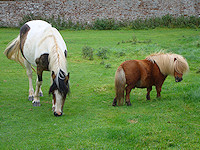
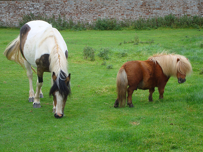
Look! It's a pony
|
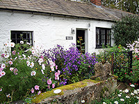
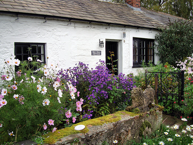
Cottage
|
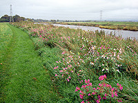
Wildflowers along the Eden
|
|
|
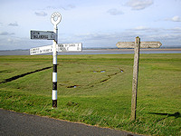
Almost there
|
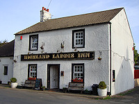
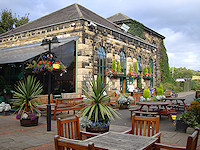
Highland Laddie Inn
|
Warwick Lodge in Carlisle
|
|
|
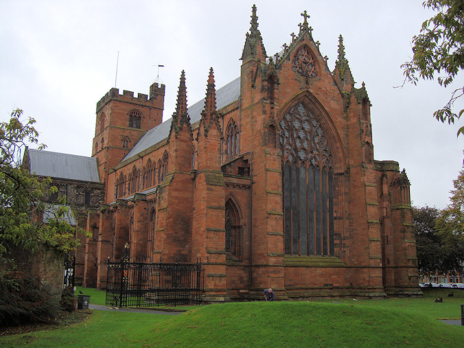
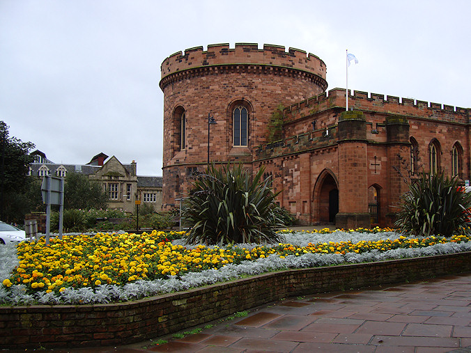
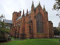
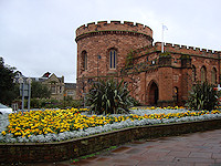
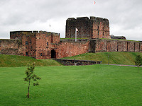
Carlisle was the largest town we
encountered since leaving Newcastle, so we indulged
ourselves in some sightseeing as we visited the castle and
the cathedral before finding a good Indian restaurant for
dinner. In retrospect, this might have been a poor
choice of cuisine the night before an all day hike, but we
were both craving a good curry. Our guesthouse was one
of the nicest we had experienced during the entire trip, so
we slept in a bit and enjoyed a nice salmon omelet breakfast
in the morning before setting out along the river,
backpack-free for the first time in a week.
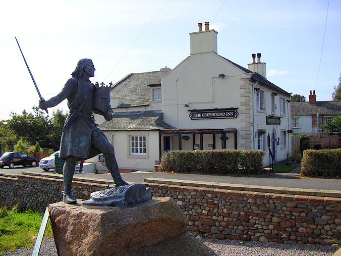
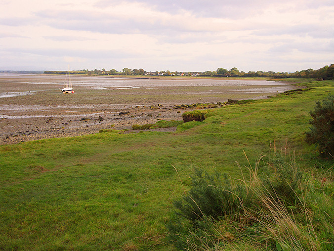
After a brief but hearty lunch at
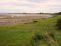
the Greyhound Inn, the horizon opened up as the River Eden broadened into
the Solway Firth. Our path turned into a long, straight
paved road which was trying on our tender feet but at least
it as flat. It ran on for miles with a ditch and an embankment
to our left and pastureland leading down to the firth on our
right. The day was sunny and cool – perfect for the last leg
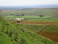
of the walk. We moved along at a pretty good clip stopping
occasionally to avoid a passing car or one of the cows
taking a break from grazing in the pasture to block the
road. We were making steady progress to Port Carlisle with J
out front as she usually did when there weren’t cow pies to
worry about. Suddenly she stopped, turned to look back where
we had just been, and yelled “BULL!” before bolting down the
road. D took a quick glance behind him to see a young bull
galloping toward him at full steam. Now we have all heard of those
supernatural feats of adrenaline-induced strength such as a
mother lifting a car off of her trapped child. Well this was
our car-lifting moment. Despite soreness and blisters, we
ran for our lives. Things seemed to be happening in slow
motion, and maybe they were, because the bull was gaining on
us fast. Determined not to be the fourth and fifth hikers
trampled to death by a cow in the UK that year, we dove to
our left, cleared the ditch, and clung to the embankment for
dear life. Where we had gone left, the bull went to the
right to meet up with a friendly heifer, the object of his amorous
intentions from the start.
We decided that after our near death experience, we needed a
pint in a big way, and the Highland Laddie Inn looked as
good a place as any. Thanks to the level ground and our unexpected sprint, we still had plenty of time before
nightfall. We were finally able to take our time and really
enjoy the last segment of the trek. We stopped for a last
"trail ale" at the Hope and Anchor Pub before
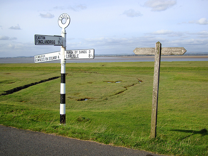
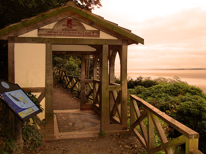
entering Bowness-on-Solway, the end of the road. We found
the last stamping station to complete our Hadrian’s Wall
passport and then posed for an obligatory self portrait at
the pagoda marking the official end of the trail just as
the sun began to set. It was a bittersweet feeling. We were
battered, blistered, and chaffed, but we had a great sense
of accomplishment and were sorry that it was all over.
We still had some time before the last bus back to Carlisle,
so we headed straight to the King’s Arms for a couple of
celebratory pints and to collect our certificate for having
all the stamps in our trail passport. After the barman
pulled our ales, D proudly slid him both completed passports
and inquired about the certificates. He apologized but said
that they had run out of certificates in June and had not
received any new ones from the Trust. He suggested we stop
by in a month and check again.
|
Carlisle Cathedral
Last chance to take the bus
The Hammer of the Scots
St. Mary Beaumont
Solway Firth
|
|
Carlisle Citadel
|
Finish line
|
Carlisle Castle
|
|
|
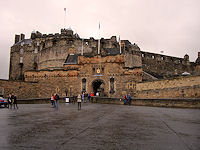
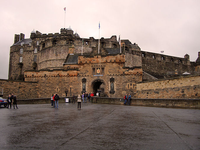
Edinburgh Castle
|
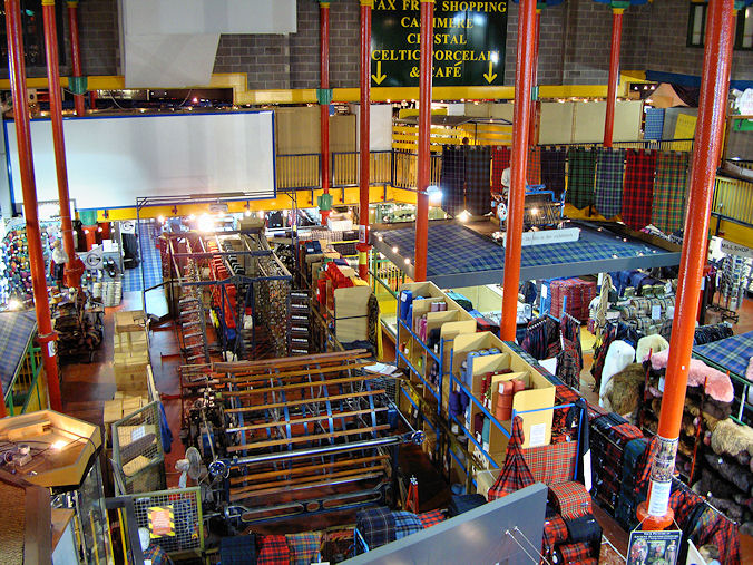
Tartan looms
|
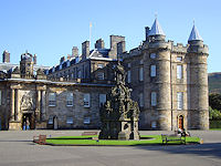
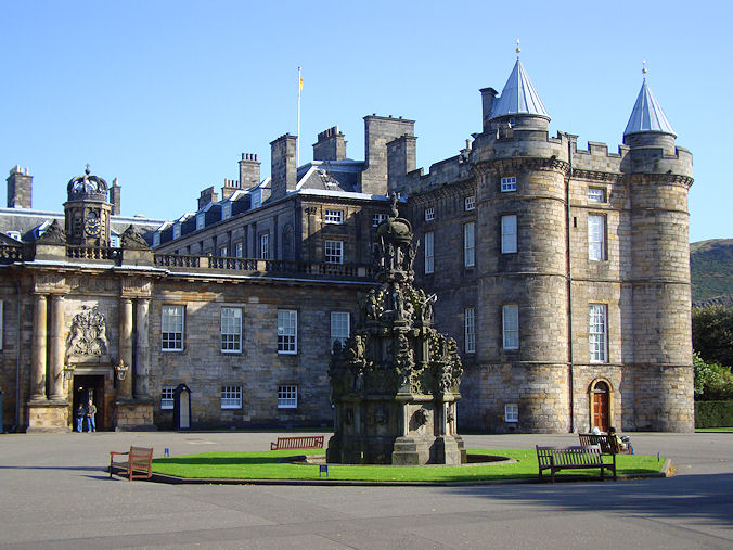
Holyrood Palace
|
|
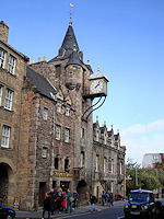
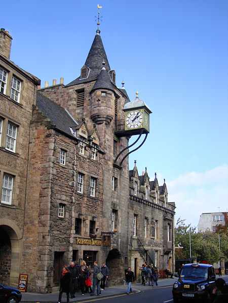
Tollbooth Tavern
|
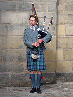
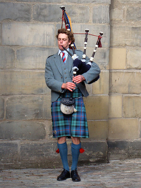
Piper
|
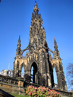
Walter Scott Memorial
|
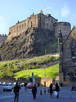
Castle rock
|
|
|
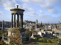
Calton Hill
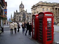
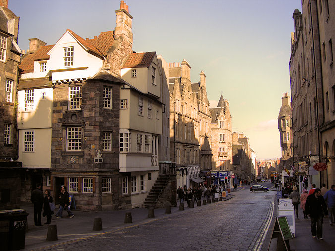
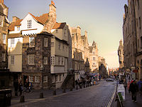
The Royal Mile
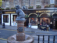
Greyfriars Bobby
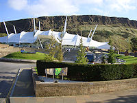
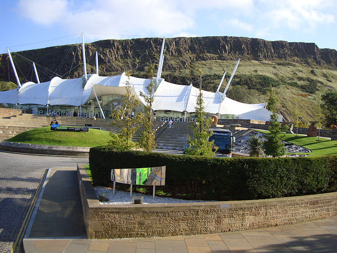
Dynamic Earth
|
It's amazing how fast the miles go by when you
are on a train. That thought kept running through our heads
as we retraced some of our steps on the train from
Carlisle to Edinburgh. After completing our 84 mile trek, the last
thing we wanted to do was walk anywhere, so the
climb from the Edinburgh station to our hotel right
on the Royal Mile took much longer than the normal
visitor. We
were wonderfully situated on the famous thoroughfare linking
Edinburgh Castle with Hollyrood Palace, but the
notion of doing any sightseeing on foot was out of
the question.
So despite the chilly October weather, we rode
around town on the open air hop-on hop-off buses to
see as much as we could. Save for a short stop to
take the chill off at the Last Drop pub in Grassmarket, the
former location of the city gallows, there wasn't much hopping off, and we found
ourselves spending most of the evening in the
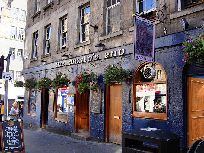
World's End pub still nursing our wounds.
But on the second day, we felt much improved. We opted for the buses again to get from
point to point, but this time we disembarked a
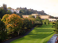
number of times to see the sights of Edinburgh. We braved the walk up Calton Hill as a
stunning view of this ancient city unfolded before us
with the massive Castle Rock dominating the scene.
With some weather moving in, we retreated back to the Royal
Mile where we could limit our walking to the short
distance between pubs. We popped into the Ensign Ewart which has
been a pub since the late 1600’s. We gingerly managed the stairs down to the
Jolly Judge for a cask ale or two. Our next stop was the uber-touristy Deacon
Brodie Tavern, whose namesake, William Brodie, led a
double life as a furniture maker by day and a burglar
by night. It
is said he was the inspiration for Scottish son,
Robert Louis Stevenson’s story of Jekyll and Hyde.
Everywhere we went served fine Scottish whisky,
and a number of whisky houses were within reach, but we just
didn’t have a taste for it and settled for ales instead. We could have added to our Edinburgh mini-pub crawl,
but our feet were still tender, so we decided to park
ourselves in the Advocate just beside our hotel for a
Belhaven and a bite to eat. This gave us time to reflect proudly on our week-long
accomplishment and our willpower to resist using
the bus. We covered
the entire 84 mile distance on foot – a journey that
would forever impact both our souls and our soles.
|
|
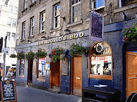
The World's End
|
National Gallery
|
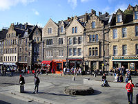
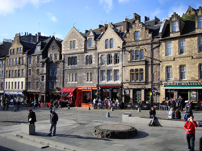
Grassmarket
|
|
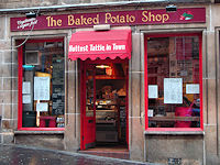
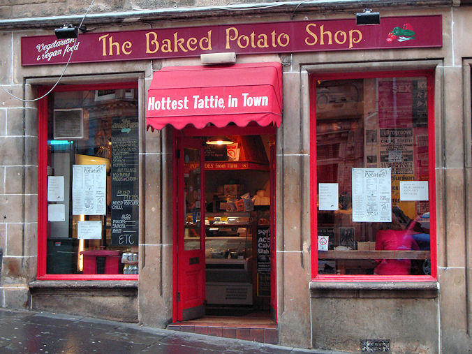
Jacket Potatoes
|
John Knox House
|
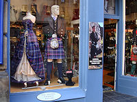
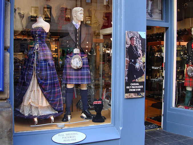
Kilt shop
|
|
Copyright © 2005 JnDsTravelog.com. All rights reserved. |
| |