|
<<Back |
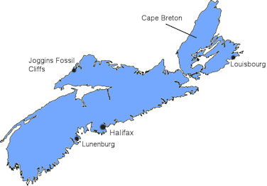
Nova
Scotia, Canada
Aug.
7-15, 2010 |
|
|
|
J had been engulfed in a project for work requiring
early morning phone calls to India and several 70+ hour
weeks. We were aching to get out of town but couldn't
make any plans because of the precarious nature of her
project. Finally, it looked as if J could sneak away for
a week in mid-August without all hell breaking loose. We
had to pick a destination within driving distance, and a
place to beat the summer heat would be ideal.
All signs pointed toward a week of golf on Prince Edward
Island or driving tour of Nova Scotia. Since neither of
us had stepped on the links for some time, Nova Scotia
won the day. |
|
|
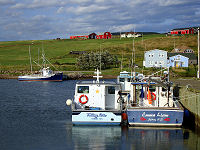
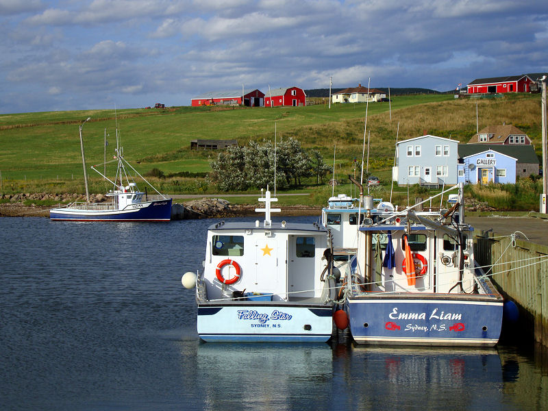
Fishing boats
|
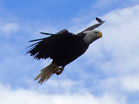
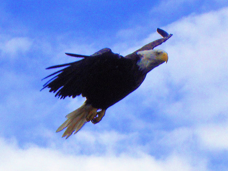
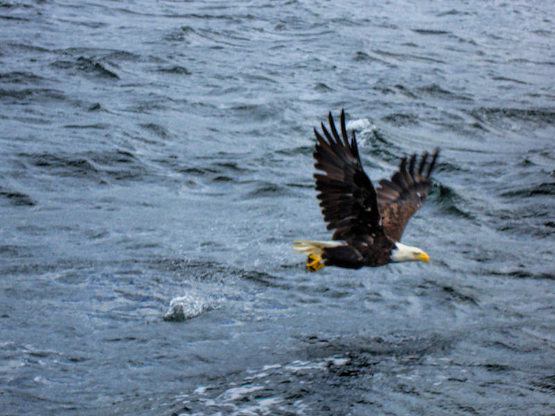
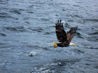
Bald eagles patrol the coast
|
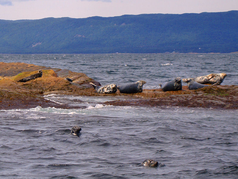
Sea lions lounging in the sun
|
|
|
Rather than take the ferry across the Bay of Fundy,
we elected to drive up and around through Maine and
New Brunswick. It would take an extra day each way
but would save us some money and give us a chance to
bond. Fourteen hours after piling into the car we
arrived in Cape Breton – more than sufficiently
bonded. We decided on a bed and breakfast in North
Sydney as our base of operations. We are not really
B&B people. They always sound like a good idea, but
in reality we would be much more comfortable
sleeping in a hotel rather than someone's house. The
old creaky beds, the tiny bathrooms, the awkward
conversations at the breakfast table – definitely
not for us. Nevertheless, the romanticism got the
better of us and we booked two nights in a 140 year
old B&B.
Cape Breton was part of the
French Acadian territories and was known as Isle
Royale. After the treaty ending hostilities between
France and England following the War of Spanish
Succession, France ceded all of its Acadian holdings
on the peninsula to Great Britain with the exception
of Isle Royale. Despite peace, tensions between the
catholic French and the Protestant English remained
strong. The English demanded that the Acadians take
an oath of allegiance to Great Britain. The years
that followed saw thousands of defiant French
Acadians deported to other colonies (some settling
in Louisiana were “acadian” became “cajun”) or back
to Europe in what became known as the Great
Expulsion. Ultimately, in 1763, the English gained
legal claim over Isle Royale and unified the Nova
Scotia territory.
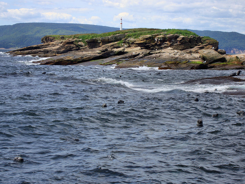
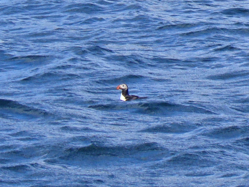
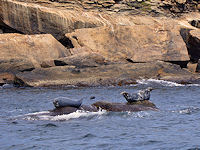
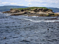
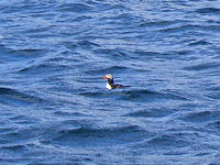
Our first morning began with a brisk boat ride from
Englishtown to see the “bird islands” at the mouth
of St. Ann's Bay. While the tour was advertised as a
puffin watching excursion, we saw only a few fishing
in the water as nesting season had ended weeks ago.
We saw scores of seals sunning on the rocks and a
number of bald eagles circling and looking for a
quick meal. After we docked back in
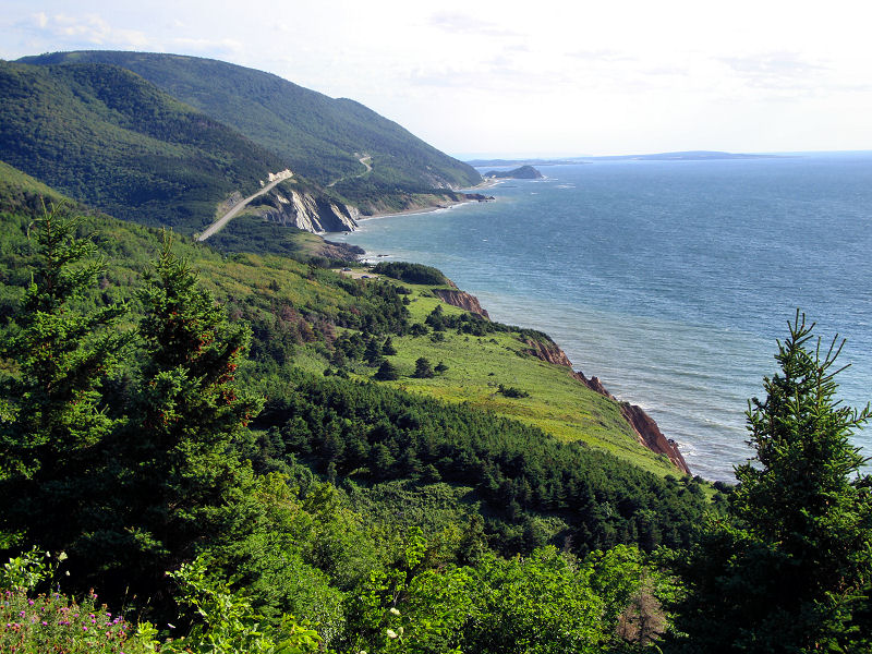
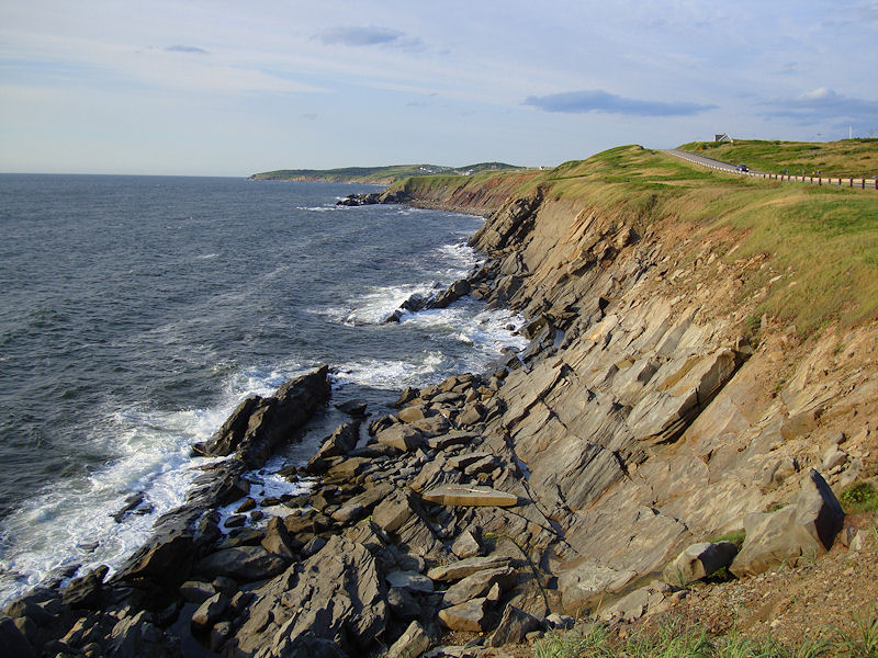
Englishtown, it was back in the car again for a lap
around Cape Breton Provincial Park along the scenic
Cabot Trail. We paused for lunch in Ingonish and
took another break in the Acadian settlement
Cheticamp. The scenery along the coastline was
stunning, and J felt a twinge of homesickness as it
was reminiscent of Highway 1 in California.
We left for Halifax the next
day but took our time and drove out to the eastern
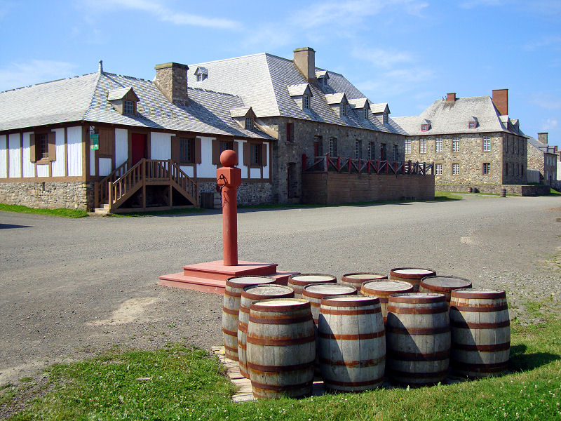
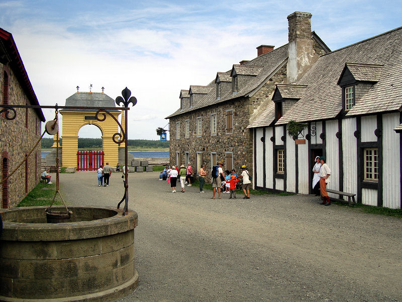
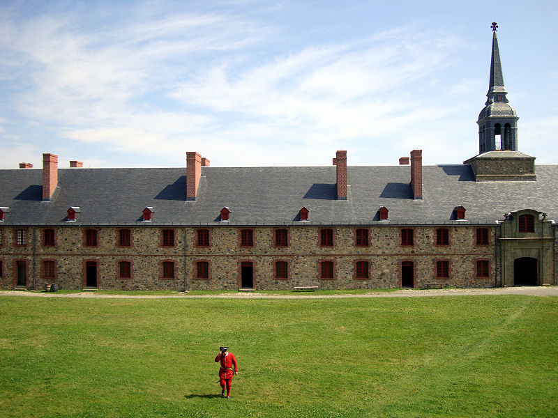
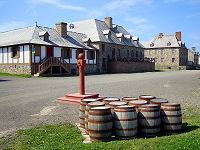
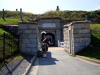
shore of Cape Breton to visit Fortress Louisburg.
After the French lost their colonial capital of Port
Royal to the English, they constructed a grand
fortress to serve both as a port to supply the
Acadians and also to protect their remaining
holdings on Isle Royal. The English captured the
fort several times before finally dismantling the
fortifications to ensure it could not be used as a
defensive position in the future. Today the fort has
been reconstructed, albeit only to a quarter of its
original size, and is full of interpreters who
speak about how it was to live in Louisburg and
provide demonstrations of a number of 18th century
activities including public flogging. Moving on, we
continued along our coastal drive enjoying the
splendid picturesque fishing coves and pulled into
Halifax late in the evening.
|
Sea lions and seals abound
Almost had lunch
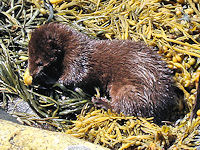
A mink dining on shellfish
Heads popping out of the sea
The lone puffin we spotted
|
|

A drive down the coast
|
The Acadian town of Cheticamp
|
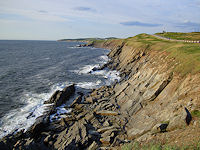
Cape Breton coastline
|
|
The flogging pole
|
View to the quay at Louisbourg
|
Parade grounds
|
|
|
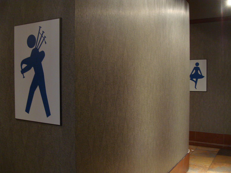
Signs of Gaelic
|

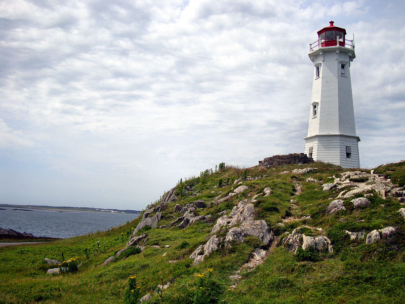
Louisbourg lighthouse
|

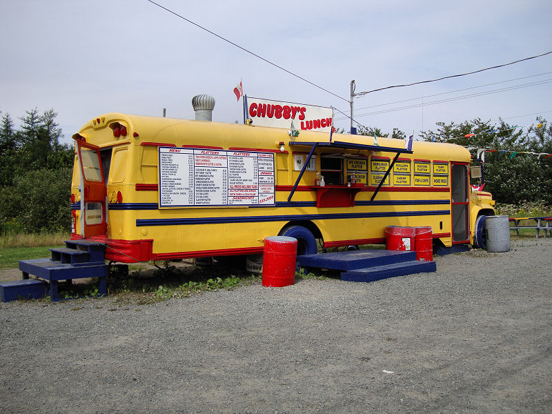
Lunch at Chubby's
|
|
|
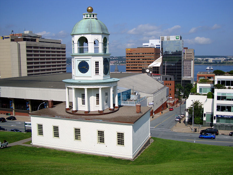
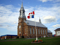
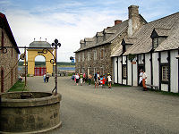
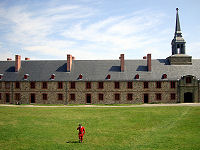
While the capital of Nova
Scotia and its largest urban area, Halifax is a bit
odd in that it is not technically a city. It is a
municipal area that encompasses the Halifax
peninsula along with seven other towns. The British
found the natural peninsula on which Halifax now
resides to be an ideal strategic site. Despite the
fact it was land belonging to the Mi’kmaq nation,
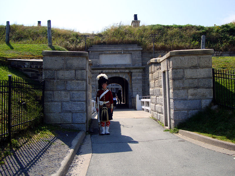
they began building the Citadel in 1749 as well as
several additional forts in the area to protect the
future city. Eventually, the British and their
indigenous neighbors quite literally "buried the
hatchet" in a 1761 ceremony. The city thrived and
became the headquarters of the Royal Navy in the
North America for 60 years.
Halifax played a role in two
additional notable maritime events. Ships from the
area helped recover bodies from the Titanic in 1912,
many of which are buried in the local cemeteries. It
was also the site of accident involving a French
munitions ship during World War I. The Mont Blanc
collided with another ship resulting in a fire and
an explosion that destroyed the northern part of the
city. The blast also had the dubious distinction of
being the largest man-made explosion until the
testing of the atomic bomb in 1945.
We decided to confine ourselves to the peninsula
that was the original British settlement in Halifax.
The full day we spent here was meant as a day of
leisure and above all no driving. We roamed the
streets, popping into the odd pub, and eventually
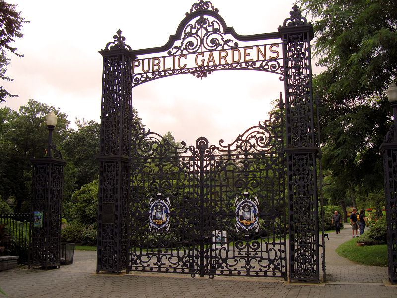
made our way through the public gardens up to the
citadel to take in a view of the surroundings. There
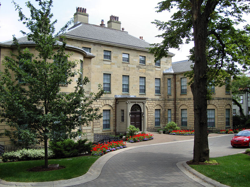
are a few buildings left of historic value such as
the Government House, clock tower, Henry House, but
the real charm of Halifax can be found at its
waterfront. Here one can stroll around the old wharf
buildings that have been converted into shops,
restaurants, and bars. Street performers attract
crowds of locals and tourists alike, and boat tours
of Halifax harbor leave frequently.
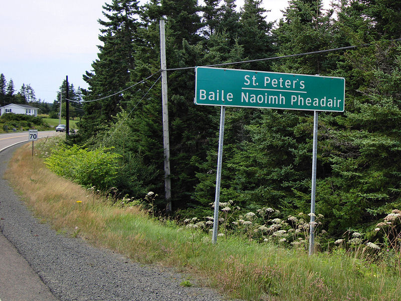
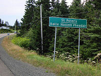
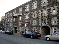
Nova Scotia has been the
destination of thousands of Scottish immigrants over
the centuries –after all the name itself means New
Scotland – and the cultural influences are evident
in the architecture, music, food, and even language.
There are several thousand Gaelic speakers in Nova
Scotia and some of the road signs are posted with
Gaelic place names. Halifax has embraced its
Scottish roots and its pub culture suited us well
for both food and drink.
|
Lads and lasses
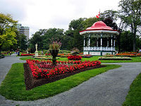
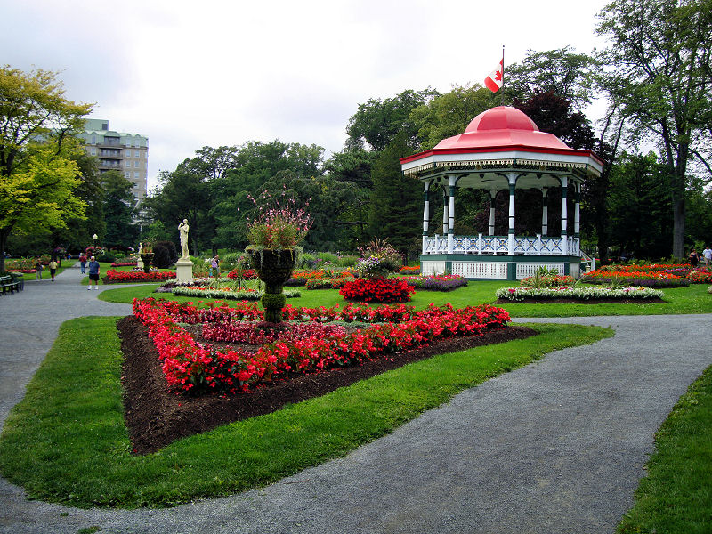
St. Pauls Gazebo

Halifax public gardens
The Citadel
|
|

Government House
|
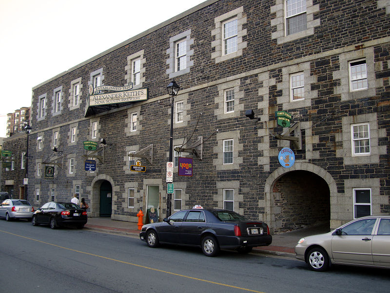
Alexander Keith brewery
|
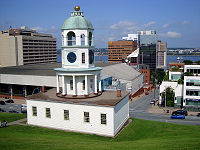
Halifax Town Clock
|
|
|
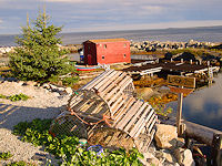
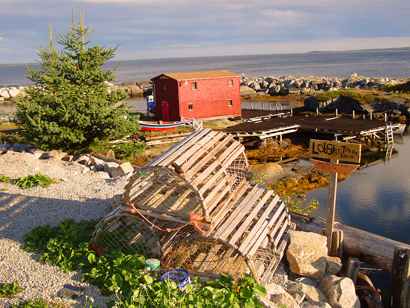
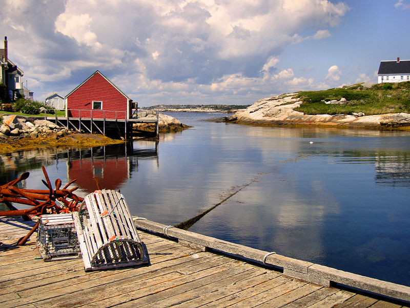
Lobster traps
|
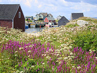
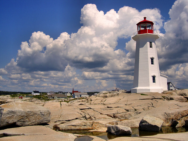
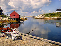
Peggy's Cove
|
Idyllic Nova Scotia
|
|
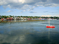
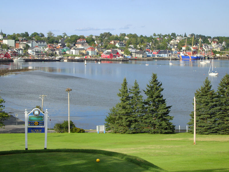
The seaside town of Lunenburg
|
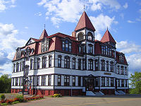
Lunnenburg Academy
|
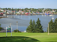
A view from the links
|
|
|
It is rare for us to have
idyllic weather during our travels, but such would
be the case for our week in Nova Scotia. Blue skies
with only a hint of clouds and a temperature that
did not exceed 78. As we pressed on south of
Halifax, we took advantage of the weather and drove
the roads that hugged the coastline known as the
South Shore Trail. This is postcard scenery of Nova
Scotia with spectacular views of seaside towns, and
we stopped frequently to take them in. Sadly, we
arrived at the picturesque Peggy's Cove just as the
Carnival Cruise excursion buses discharged their
payload, but the charm of this small fishing village
is still surviving its rapid commercialization. As
dusk was descending, we came to Blue Rocks, a tiny
fishing harbor which still seems to be a well-kept
secret judging from the deserted roads. We walked
the shoreline as the sun began to duck below the
horizon and gazed upon some of the most striking
scenes we had ever encountered in our travels. We
finally arrived in nearby Lunenburg after dark to
check into a motel overlooking the ocean.
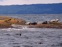
It was time to get our legs
moving again, so early the next morning, we drove to
Keji Seaside Adjunct for a hike. While the main Keji
park is located inland around a lake, this adjunct
covered a small peninsula on the coast. We completed
both of the two rather easy trails which run along
the coastline rife with seabirds and seals warming
themselves in the early morning sun. The rest of the
day was spent meandering the streets of the
Lunenburg old town, a UNESCO world heritage site,
and sipping some beverages dockside.
|
|
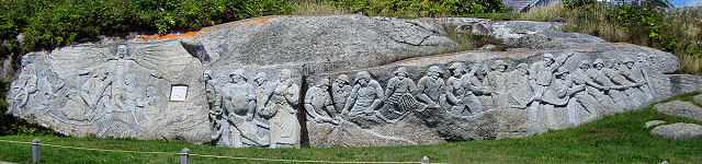
Fishermen Monument
|
|
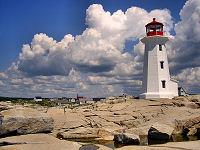
Peggy's Cove lighthouse
|
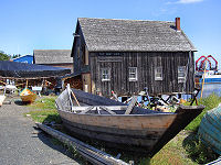
The Dory Shop
|

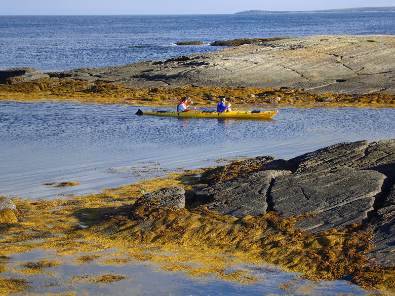
Kayakers
|
|
|
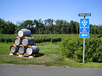
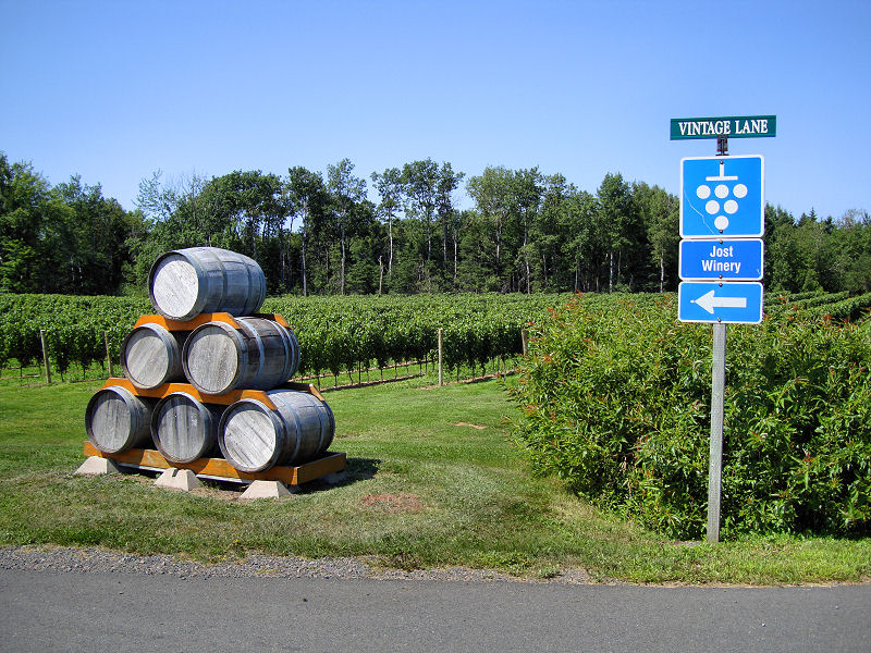
To the grapes
|
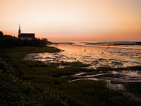
Northumberland sunset
|
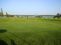
J chips one close
|
|
|
Though we would have liked to
the southwestern part of Nova Scotia more thoroughly
and visit some of the sights near Anapolis Royal,
our week was rapidly coming to an end, and it was
time to head back. Our next stop was the
Northumberland shore for a visit to the Jost winery,
maker of some fine eiswein, including a maple
version, and an afternoon of golf at a links-style
course on Brule Point.
That night we conspired to
try and see one more sight early in the morning
before we drove back. We are both rockhounds and
always like to add new UNESCO World Heritage sites
to our list, so it was only natural that we made a
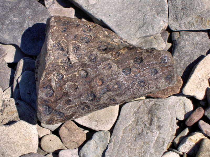
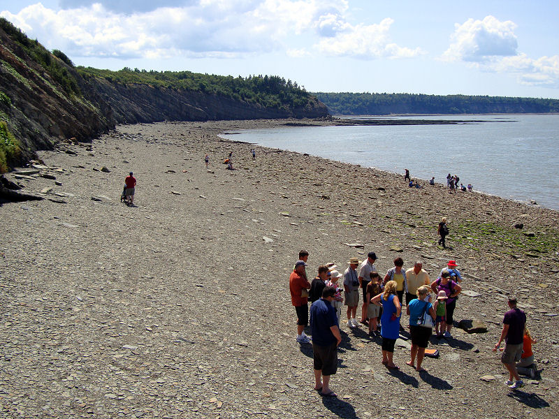
quick stop at the Joggins Fossil Cliffs on the Bay
of Fundy. After a quick look in their visitor
center, we roamed the beaches finding some
interesting fossils. More than 300 million years ago
this part of the world was an equatorial dense
forest crawling with amphibians and insects. Most of
the fossils we found had imprints of vegetation such
as ferns, but some looked to have tracks or even
body parts of insects. Despite finding some choice
samples, we were alas not allowed to take them home.
Joggins has a strict no keeper policy to sustain the
site for researchers and other visitors, so we hit
the highway toward Moncton with the hopes of being
home by nightfall.
|
|
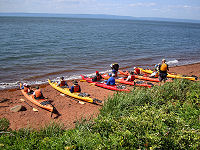
What's up with all the kayakers?
|
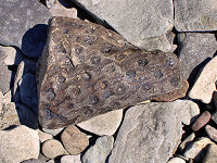
Fossil find
|

Fossil hunters
|
|
Copyright © 2005 JnDsTravelog.com. All rights reserved. |
| |