
|
<<Back |
Savoie, France
July 2005 - January 2006 |
|
|
|
| After a moderately
successful stint in Provence,
D found himself returning to France for another extended
stay. This time he was stationed in the mountainous
Savoie region in the southeast - an area known for Alpine
skiing and hearty food like fondue, raclette,
and tartiflette. While his work was in Chambéry,
he made his temporary home in the charming resort town
of Aix-les-Bains. J stayed in the States to carry on
with her job but flew over a number of times during
the nine months D was there to see some of the area's
beauty and meet some of the people D has befriended.
In addition to the seeing the sights of the Savoie region,
J joined D for a number of side trips including Geneva,
Torino,
the Veneto, and even Köln for New Year's. |
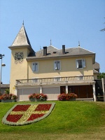
Symbols of the Savoie |
|
|
|
Chances are you’ve never heard of
the Savoie, which is known to the English-speaking world
as Savoy. To be perfectly honest, neither did I. But it
would be negligent to not find out at least something in
advance about where I was going, so I’ll share what little
I know. Of course, I knew about the more famous parts of
the region such as Mont Blanc, Chamonix, Grenoble, and Lake
Geneva, but as I found out, there is much more to the area.
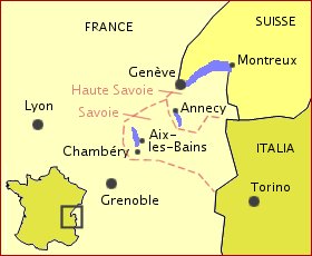
Today, Savoie refers to one of the
hundred or so départements that make up France.
Adjoining it to the north is the Haute-Savoie (High Savoie)
which the areas along Lake Geneva (see my nifty map above).
To the east, both départements are bordered
by the Alps, along which runs the French-Italian frontier.
Lake Geneva constitutes the border with Switzerland. However,
prior to its annexation by France in 1860, the Savoie was
a sovereign state that included western Switzerland, the
Piedmonte region of Italy (the westernmost part of Italy
around Turin), and extended westward almost to Lyon and
as far south as Nice. It encompassed almost all of the western
Alps, making it a strategic, and therefore desirable, region
throughout its history.
The history of the Savoie is somewhat
complicated, but I’ll give you the 50 cent version here
for the sake of brevity. As usual, we’ll start with the
Romans who made their way into the area in the 1st century
BC. Encountering moderate resistance from the Gallic tribes
of the area, most notably the Allobroges, the Romans built
founded some towns, established major roads, and increased
the agricultural productivity of the area. The post-Roman
era saw the Savoie have strong influences from the Kingdom
of Burgundy to the north, and it was eventually included
as part of Lotharingia after the breakup of Charlemagne’s
kingdom. The House of Savioe was established by the last
Burgundian king, Rudolph III and maintained its independence
under Humbert White-Hands after the Savoie officially became
territory of the German Emporer, Konrad II. The Counts of
Savoie flourished in the Middle Ages by controlling trade
across the Alps, and established a capital at Chambéry
along the old Roman road between Grenoble and Geneva. By
creating a senate at Chambéry, investing tax money
back into the maintenance of the state, and giving political
and judicial power to local magistrates throughout the Savoie,
the Counts of Savoie created a recipe for government that
allowed the region to succeed as a sovereign state for nearly
a millennium. The Counts of Savoie eventually became dukes
and finally kings, once Sardinia was added to the kingdom.
But alas, the strategic location
of the Savoie nation and the sheer size of its territory
eventually led to its dismantling. Owing to various kings
named Louis and a couple of Napoleons, all of whom desired
the Alpine region, the western and northern parts of the
Savoie were constantly invaded by French troops. Fearing
the inevitable, the House of Savoie moved its capital from
Chambéry to Turin on the other side of the Alps.
Eventually, the parts north of Lake Geneva were ceded to
the Swiss Confederation. Through a secret deal in 1859,
King Victor Emmanuel II, handed over the original Savoie
region west of the Alps to Napoleon III in exchange for
the aid of 200,000 French troops to fight off the Austrians.
The investment paid off when Victor Emmanuel eventually
succeeded in driving away the Austrians, united Italy, and
became its first king. His descendants ruled Italy until
World War II. Today, the House of Savoie still exists with
Vittorio Emanuele, Prince of Naples as its sovereign.
The Savoie people retain a unique
identity, and an acute nationalism is pervasive. The inhabitants
still have strong ties to Italy and Switzerland, the influence
of which can be detected in their features and their cuisine.
It is impossible not to notice the Savoie flag displayed
prominently throughout the area, noticeably more than the
French flag. The ancient Savoie language is derived from
Latin, but has not experienced the same revival as Provençal,
and is rapidly fading.
|
|
|

Château des Ducs de Savoie.
|

All you need to know about Chambéry.
|

Cathédrale Saint-François.
|
|
|
Nestled between the Bauges and Chartreuse
mountains and only a stones throw away from Lac du Bourget
is the city of Chambéry, historical capital of the
Savoie. The Romans founded the settlement of Lemincum on
the marshes here as a watering hole along the main roads
from Milan to Vienne and Grenoble to Geneva. Today, the
city has about 60,000 inhabitants and is fairly modern with
some basic industry, the University of Savoie, and numerous
museums of art and culture. The old town, having largely
been rebuilt after a WWII bombing raid, is a unique mixture
of broad sweeping pedestrian zones and narrow medieval alleys.
The real jewel of the city is the
château which became the main residence of
Savoie royalty in the 13th century as well as housing the
Savoie senate. The castle was damaged by fire and rebuilt
on numerous occasions, but saw a fair share of residents
from the Savoyard counts to Napoleon III to a Don Felipe
when Chambéry was briefly under Spanish occupation
in the 18th century. In 1502, the Duchess of Savoie had
a special chapel built into the castle to house her most
prized possession – the Holy Shroud. As with the capital,
the Shroud was eventually moved to Turin for reasons of
security.
Aside from the château,
Chambéry's most notable monument is the statue
built for native son General Benoit de Boigne to commemorate
his exploits in India. The sculpture displays the
heads of four elephants and has some very ornate bronze
work from the Grenoble-born sculptor. Sadly, it has
nothing to do with Hannibal as we had hoped. The Carthaginian
general is believed to have taken the less scenic
southern route across the Alps, which makes sense
considering his mode of transportation.
One last claim to fame is that Chambéry
was the home of celebrated French (though he was born in
Geneva) philosopher Jean-Jacques Rousseau for almost a decade
when he was a young man. He reputedly did pretty well with
the ladies as he taught music to many of the young socialites
of the day. His first mistress, Mme de Warens, lived and
eventually died in Chambéry. Rousseau is well-known
for his theory that man is ultimately noble at the most
basic level and that society corrupts him. His political
works preached the role of the masses in sovereignty and
are considered by some to have been the roots of communism
and socialism. The statue commemorating the influence Chambéry
had on Rousseau was ironically melted down by the Nazis
for weapons. |

The château's Sainte-Chapelle

Stained glass in the chapel.

Christ and the Holy Shroud.
|
|

Fontaine des Elephants
|

Café outside the theater.
|

An alley in the old town.
|

A view toward the château.
|
|
|

High in the Beaufortain mountains.
|

A chalet along our route.
|

The locals were no help.
|
|
|
Prior to our departure for
Italy, weI found ourselves with a gorgeous Sunday
to exploit. D had discovered a stunning picture of
a nearby citadel in one of his many guidebooks and
decided that it was within our range of capabilities
to ascend the mountain on which it was perched. So
early in the morning, we stuffed a couple bottles
of water in our backpack and headed to the Beaufortain
region near the town of Bourg Saint Maurice to begin
our assault. Eventually, we found the tiny road that
climbed from the village up toward our objective.
The road narrowed significantly to the point where
it was essentially a one way road. At about 3000 ft
above the town below, D began to get a little nervous
about encountering cars coming the other way, so we
parked our trusty voiture where the paved road
ended and ventured out on foot.
We walked up the moderate incline
for about an hour and could see the noticeable progress,
but we still had no sight of the fort. After another
hour, we not only began to get tired, but started
to doubt the route we had taken. We agreed to go for
another half hour and then turn back if we didn’t
reach the fort. So after two and half hours of incessant
uphill-walking, we agreed to head back down in defeat.
There were considerable accusations and finger-pointing,
but there's no need to dwell on the negative. Suffice
it to say that some poor judgment and map reading
led to the whole fiasco. Nevertheless, we had a challenging
hike with some exhilarating views of the French Alps.
On the drive down, we passed
a sign indicating the turn we had missed that would
have led us to the fort on the neighboring mountain.
D vowed to return at all costs and see that fort.
|
|
|

The Porte de Savoie leading into Conflans.
|

The former Olympic flame at Albertville.
|

Albertville Olympic skating center.
|
|
|

The main square in Conflans.

Fountain in medieval Conflans.

The baroque church of St. Grat.
|
One of the first things that comes
to mind when thinking of the Savoie should be the Olympics.
The region is renowned for its skiing areas and has played
host to three Winter Olympic Games – the inaugural Winter
Games in Chamonix (1924), Grenoble (1968), and most recently
Albertville (1992). In fact, the next Olympics this coming
February is set for Turin, a former capital of the Savoie.
As it were, we decided to visit
Albertville to check one more former Olympic host
city off of our list. D's friend had described Albertville
as this: Before the Olympics it was a small town,
during the Olympics it was a big town, and after the
Olympics it is a small town again. This turns
out to be a pretty accurate description. One characteristic
of the Winter Games is that the majority of the competitions
don’t actually take place in the host city but rather
in the surrounding mountain villages. So our visit
to Albertville yielded only a view of the Olympic
stadium and skating venues.
But Albertville possesses another
little jewel in the form of a medieval town perched above
the Olympic city. Conflans, its name derived from its location
at the confluence of the Isère and Arly rivers, thrived
as a stop along the trade route through the Alps between
Milan and Vienne. The Hospitallers of St. John of Jerusalem
(also known as the Knights of Malta) built a hostelry here
to shelter pilgrims and eventually crusaders en route to
the Holy Land. Today the town hosts only tourists as most
of the buildings are shops, galleries, and artist workshops,
but it still retains the charm of a walled city from the
middle ages.
|
|
|
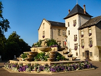
Aix-les-Bain's town hall.
|
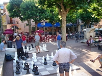
Chess in the afternoon.
|
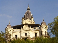
Le Roche du Roi.
|
|
|
As previously mentioned, D
made his home for nine months in Aix-les-Bains, a
lakeside resort town about 20 minutes north of Chambéry.
Vacationers come not only for the mountain air or
the boating and swimming opportunities but also for
the thermal baths. Bains means baths
and Aix is derived from the Latin aquae,
so it’s not to difficult to realize that the Romans
discovered this area and dipped their toes in the
100+ degree water from time to time. There is an arch
dowtown that was part of a mausoleum because the Romans
believed thermal baths were entrances to the underworld.
Now we just build casinos near them. Today, there
are three national baths in Aix – Thermes Pellegrini,
Thermes Chevalley, and Thermes Marlioz – and French
curistes come from all over the country to
use the healing waters. There is a poster with drawings
depicting the various treatments. Let’s just say that
no orifice is safe. We’ve heard that you must have
a prescription from a French doctor to have the "full
treatment".
Aix-les-Bains has a nice pedestrian
zone downtown strip and a beach and water park, but the
nicest part of town is down by the Grand Port. One can eat
in a number of the restaurants, browse around the boats
and yachts, walk out on the pier extending into the lake,
or stroll along the plane tree lined Boulevard du Lac towards
the Petit Port. Along the boulevard is a large park with
ice cream stands, pétanque areas, a skateboard
park, and children’s rides. It’s a great way to spend a
sunny spring, summer or autumn day with the family.
Aix’s heyday was during the Belle
Époque when it was one of the places to be during
the summer months. Queen Victoria was a regular visitor
as was other royalty. But Aix calls itself the city of writers
because, in addition to visits from Balzac, Alexandre Dumas,
and Guy de Maupassant (who went to the baths to cure his
syphilis), this lovely lakeside resort is where Alphonse
Lamartine fell in love with a married Parisian woman who
suffered from tuberculosis. They vowed to return the next
summer, but she didn’t survive to make it, and Lamartine
mourned her in his classic poem Le Lac (The Lake).
Some consider Lamartine as the first French romantic poet.
|
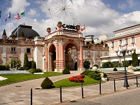
The Grand Cercle casino takes your
money regardless of nationality.
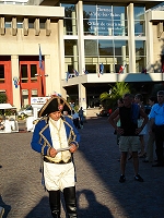
Celebrities abound.

Thermes Marlioz.
|
|
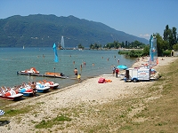
The beach.
|
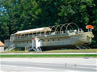
A local pub by the lakshore.
|
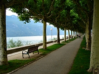
Boulevard du Lac.
|
|
|

Quaint Alsatian half-timber house
|

A reminder of who now owns the Alsace
|

Les bouches de Noël
|
|
|
The plan for the holidays was
to collect J at the airport in Lyon and head directly
up to Germany for a family Christmas with D's parents.
Just before New Years Eve, we were to join our favorite
senior citizen bus tour from previous trips to Lower
Bavaria and Montegrotto for a tour of Köln in
the heart of the Rheinland. Needless to say,
J was suffering greatly from sleep deprivation after
spending some 11 hours in the air. A long ride
in the car was not going to keep her awake for long,
and by the time we reached Besançon, she was
slipping in and out of consciousness - sometimes in
mid-conversation.
We had not planned to make
the trip all in one day, but instead made reservations
for two nights in a small hotel in Riquewihr where
D had once visited in his younger days during a family
trip to the region. This would give us at least
a full day to experience some of the Alsace at Christmas
time. What makes the Alsace special is its combination
of French-ness and German-ness. Politically,
the Alsace has bounced around between France and Germany
a number of times as you might expect from a border
region between old foes. Culturally, the Alsatians
have a unique blend that draws from both countries.
Today, it is part of France although the architecture,
cuisine, and native language lean much more toward
German.
Riquewihr, historically known
as Reichenweiher, exudes charm. The half-timber
houses lining the cobblestone streets give it that
fairytale feel. The whole town decked out for
Christmas and was surrounded by the vineyards that
produced the grapes that yielded the wine that provided
the inhabitants with a stable income for centuries.
On some of the rooftops, you could see the nests that
were home to the indigenous Alsatian storks.
We went to the Christmas market and drank some glühwein
while checking out the stalls selling ornaments and
crafts. As night fell, the lights came on to
produce an even more magical feel. J began to
fade, so we ducked into an old restaurant to dine
on choucroute garnie - an assortment of grilled
meats with sauerkraut and potatoes - before turning
in for the night. The following morning, we
needed to get an early start to complete the drive
to Germany. |
|

Downtown Riquewihr
|

Strasbourg's Christmas market
|

A stork nests atop one of the
town's watch towers
|

Decked out for the holidays
|
|

Riquewihr's modest Christmas
market
|

A small town square
|

A city gate
|
|
|
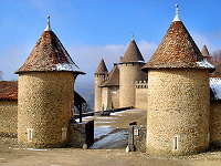
The château at Virieu
|
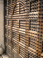
Anti-solictor door
|
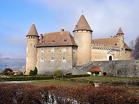
One of many castles in the Dauphiné
|
|
|
J’s holiday visit was also coming
to an end. We left early for the airport in Lyon so that
we could squeeze in a visit to Virieu. The château
at Virieu dates back to the 11th century and was part of
the lands which made up the Dauphiné. Originally
independent from France and part of the Holy Roman Empire,
the Dauphiné was traditionally ruled by the heir
to the French throne in exchange for its sustained independence.
The idea was to keep the crown prince as far away from Paris
as possible yet still keep an eye on him. Since the heir,
known as the Dauphin, was typically a child, he exercised
little authority and the noblemen of the region were in
a constant power struggle. In the mid-15th century, the
Dauphin and soon-to-be Louis IX married the nine year old
daughter of the Duke of Savoie making him a greater threat
to the French king. As a result, the king’s army occupied
the Dauphiné and claimed it for the crown.
|
|
|

Saturday market in front of Parliament
|

Last vestiges of the old Roman wall
|

Jardin de Ville
|
|
| In
eight months, D had ventured to the north, west, and
east to visit various points of interest in the Savoie
and Haute Savoie. The one glaring omission was to
the south where he still had yet to see the city commonly
known as capital of the French Alps and also the former
capital of the Dauphiné. Grenoble lies at the
junction of the Isère and Drac rivers about
30 miles south of Chambéry. We didn’t have
the luxury of waiting for a beautiful weekend, so
we made my way down the A41 on what turned out to
be a dreary and blustery morning.
Grenoble began as an Allobroges village
called Cularo before the Roman emperor Gratian (from whom
Grenoble’s name is derived) gave it city status. Little
remains of the Roman era today save for a small section
of the original wall. The city prospered by way of its location
on the trade routes between Italy and France but was handed
around between the Burgundians, Franks, and Provence before
coming into possession of the Counts of Albon who made it
the capital of the Dauphiné. It eventually became
part of France along with the Dauphiné. Thanks to
the introduction of hydroelectric power, Grenoble became
an industrial heavyweight specifically known for manufacturing
gloves.
High above Grenoble is the
Bastille - a fortress built by the French to fend
off invading armies. Access to the Bastille is gained
by the iconic cable cars, known as les bulles
(the bubbles), reputed to be the world’s first urban
cable cars. Although we strolled around town taking
in the sights, our primary goal was to visit the last
of the trio of Olympic sites in the Savoie region.
The Winter Olympics of 1968 were memorable possibly
from the performances of Peggy Flemming and Jean-Claude-Killy
but more likely because they were the first to be
broadcast on television in color. Quite a few sites
have survived the years such as the skating oval,
the hockey arena, the flame, and even the athletes’
village.
|

Fontaine du Lion symbolizes Grenoble's
struggle with flooding of the Isère and Drac.

Statue of the Chevalier de Bayard
|
|

Le Table Ronde in Grenoble is the second oldest café in France.
|

Place de Notre Dame
|

The Olympic skating and hockey venue
|
|

Les bulles return from the Bastille
|

The 1968 Winter Olympic flame
|

Site of the 1968 opening ceremonies
|
|
Copyright © 2005 JnDsTravelog.com. All rights reserved. |
| |